Conservation
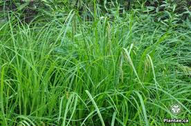
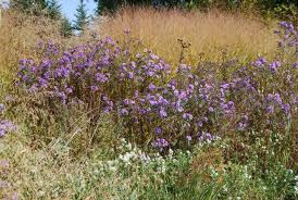
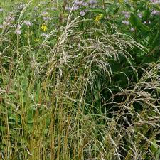
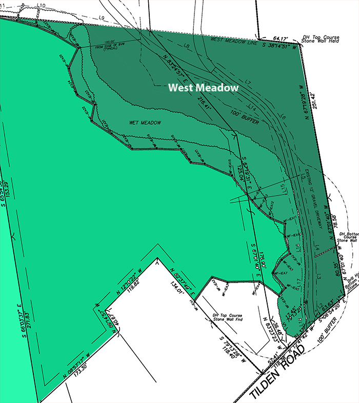
West Meadow
Ivas Environmental
Environmental Sciences
Wetlands and Planning Services
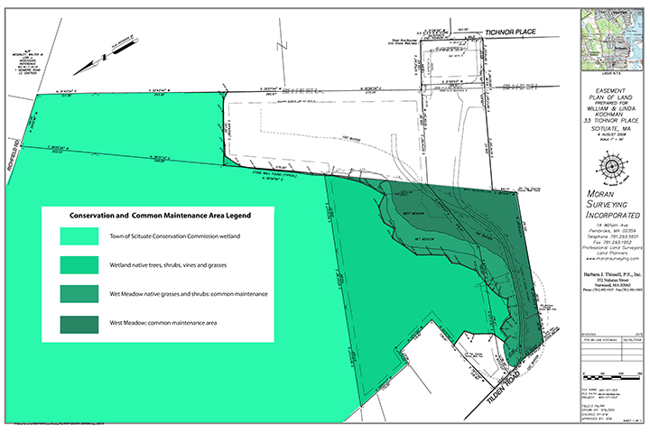
Conservation Commission
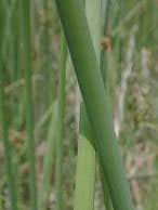
Wetland
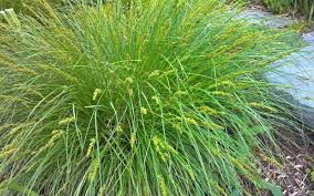
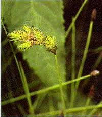
Wet Meadow
West Meadow
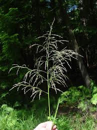
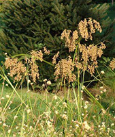
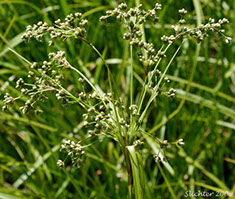
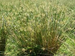
The following are excerpts describing the conservation area vegetation from Steve Ivas's study of the wetland that was deeded to the Scituate Conservation Commission by William and Linda Kochman, as well as native plants that were incorporated in the wet meadow by landscape architect and artist Tim Barner.
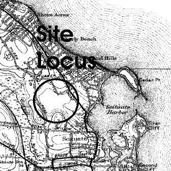
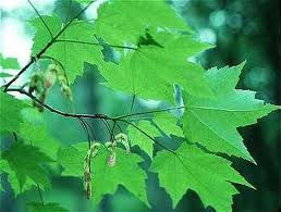
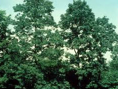
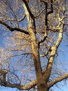
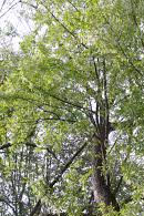
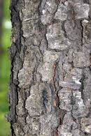
The wetland is primarily a red maple swamp adjacent to Granny's Brook, an intermittent stream that becomes tidal before it flows into Scituate Harbor.
The botanical links are to the New England Wildflower Society web-site Go Botany.
The images where not local are annonymous from google image search.
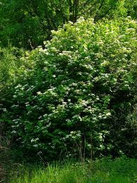
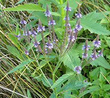
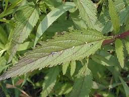
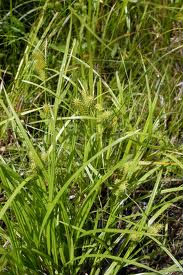
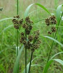
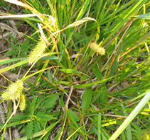
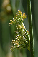
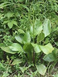
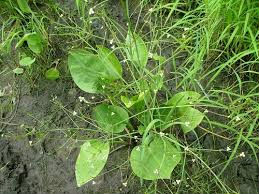
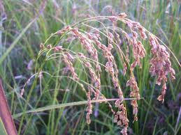
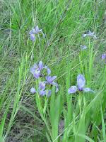
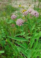
Wet meadow
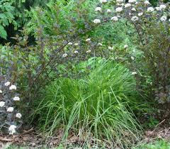
Shrub story:


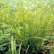
Herbaceous story:

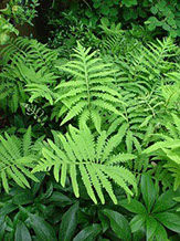
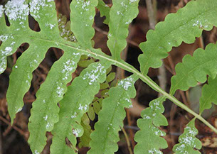


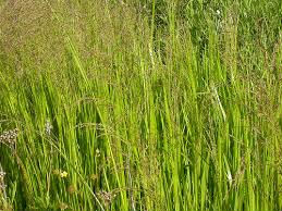


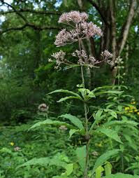
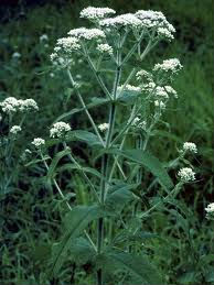


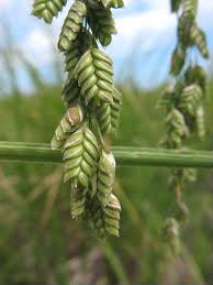


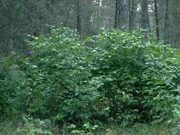
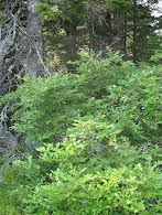
Wetland down gradient
Over story:


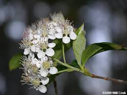
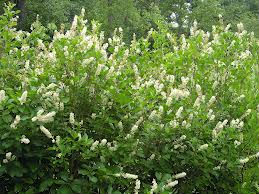
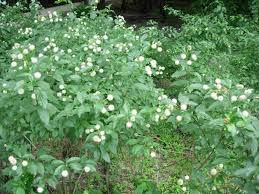
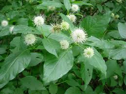
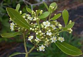
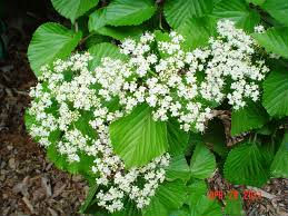
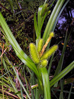
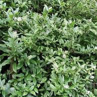
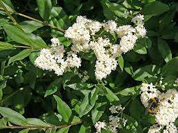
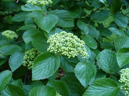
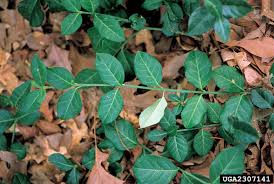
Shrub story: northern spicebush, winterberry, sweet-pepperbush,
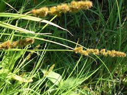
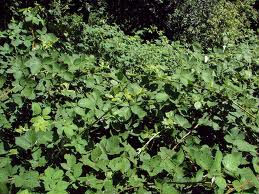
Herbaceous or ground cover story: a mix of
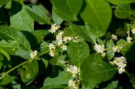
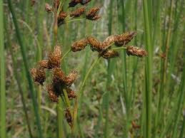
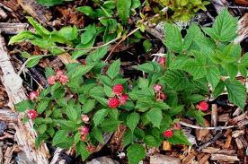
sparse raspberries
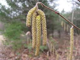
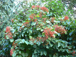
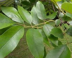
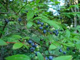
northern spicebush, sweet-pepperbush, sparse European privet, northern arrowwood, common winterberry,highbush blueberries and sparse soft rush where the delineation line cuts across the corner of an open field.
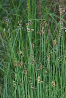
Vine story: variable - in some places it is quite thick, and in some locations is absent. It is composed of
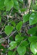
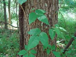
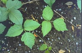
grapevines of the climbing euonymus species

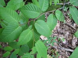
and poison ivy
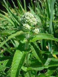
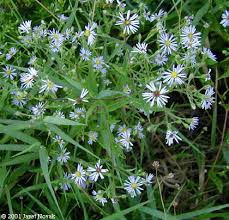
Wetland up gradient
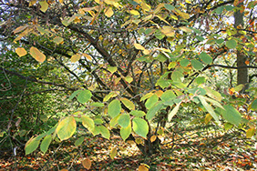
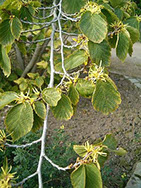
Over story: where extant, is

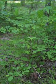
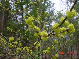
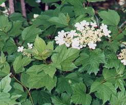
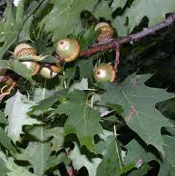
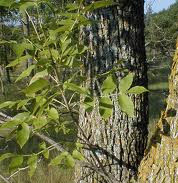
black cherry, green ash, red maple, and occasional northern red oak.
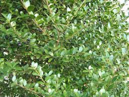
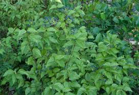
Shrub story: where extant, is a mix of European privet, black cherry, some northern arrowwood, sparse northern spicebush, highbush blueberry
Herbaceous story: European privet, black cherry, sparse northern spicebush, sparse northern arrowwood, raspberries.
Vine story: where extant is some common greenbrier.
112 AND 114 TILDEN ROAD SCITUATE_ MASSACHUSETTS
DECLARATION OF COVENANTS AND RESTRICTIONS
Declaration made this 25th day of July, 2008 by William Kochman and Linda Kochman, Husband and Wife, Tenants by the Entirety, both of Scituate, Plymouth County, Massachusetts (hereinafter referred to as “Kochman").
"Whereas, William Kochman and Linda Kochman are the owners of certain real property situated in Scituate, Plymouth County, Massachusetts shown as Lots 1 through 3 inclusive, shown on a plan of land entitled “Common Driveway Plan 33 Tichnor Place in Scituate, MA"; Scale 1" =50’; Date: November 8, 2007; prepared by Barbara J. Thissell, P.E. and Moran Syrveying, Inc.; said plan recorded with the Plymouth County Registry of Deeds as Plan No, 17 of 2008 in Plan Book 53 Page 1110; and
"Whereas, William Kochman and Linda Kochman desire to maintain the meadow shown on said plan and further maintain the meadow view from the dwelling located upon Lot 2 and the dwelling to be constructed upon Lot 3 to Tilden Road
Now, therefore, William Kochman and Linda Kochman bargain and agree for themselves, their heirs, successors and assigns, that all the land shown on the aforesaid plan is and shall be held, transferred, sold, conveyed, inherited and occupied subject to and with the benefit of the covenants, restrictions, easements, charges and liens, hereinafter set forth.
COMMON SCHEME RESTRICTION
These Common Scheme Restrictions are imposed in accordance with Massachusetts General Laws Chapter 184, Section 26, for the benefit of each owner or owners of the aforesaid lots shown on said plan. Notices recorded with the Plymouth Country of Deeds extending the period(s) of time in which these restrictions are in force may be recorded by the owners of record at the time of recording of the extension of Lot 2 and Lot 3, provided the extension is recorded
before the expiration of thirty (30) year's 1n accordance with Massachusetts General Laws Chapter 184 Section 27.
1. No use shall he made of said land which shall be in conflict with the Zoning By laws, except as the same may he lawful as nonconforming uses or by the granting of special permit exceptions or variances.
2. a. No building other than a single family dwelling and appurtenant accessory buildings shall he erected placed or maintained on any lot shown on the aforesaid plan.
b. No dwelling house or accessory building shall he constructed or externally changed upon Lot 2 and Lot 3 until there has been written approval by the owners of Lot 2 and Lot 3for each such structure or structural change thereto.
3. Utility service connections to any building(s) erected on any lot shown on the aforesaid plan shall he constructed and maintained underground.
4. No building, structure or obstruction of any kind shall he erected placed or maintained and no fence (other than exists on the date of this Declaration or as may be agreed upon by the owners of Lot 2 and Lot 3 herein) shall he constructed west of following described course:
beginning at a point along the stone wall shown as "Stone Wall Found Typical” which point is 634.83 East of the westerly corner of Lot 3 abutting land shown on said plan as land now or formerly of May E. Graham and land now or formerly of Matthew and Rosemary Brown and continuing in the direction of said stone wall across Lot 3 and Lot 2 to the southern most boundary line of said Lot 2 to land shown of said plan as land now or formerly of Thomas M Kilduff (herein referred to as the “West Meadow”).
5. To ensure maintenance of the existing meadow on Lots 2 and 3 and to ensure the maintenance of the view of same from the residences on said Lots 2 and 3 and to provide for the use and enjoyment of same, the owners of said Lot 2 and said Lot 3 are subject further to the following:
a. the West Meadow shall he mowed and maintain in a continuous manner and shall he the joint responsibility of the owners of Lot 2 and Lot 3,•
b. the owners of Lot 2 and Lot 3, and their guests shall have the right (in addition to the right to pas s and re-pass by vehicle and by foot along the Common Driveway) to walk within and through by foot the WestMeadow.
It being the intent of these restrictions to provide for the mutual enjoyment of the West Meadow, to preserve the view from the residences on Lot 2 and Lot 3 to Tilden Road, and to keep and enhance the beauty of the Valley Pasture Farm.
For title, see deed dated January 23, 1987 and recorded with the Plymouth County Registry of Deeds in Book 7446 Page 58 and a deed dated January 4, 2008 recorded with the Plymouth County Registry of Deeds in Book 35481 Page 186.
Witness our hands and seals this 25th day of July, 2008
William Kochman
Linda Kochman.
COMMONWEALTH OF MASSACHUSETTS
Plymouth, ss July 28, 2008